Feed ingestion
The tool polls Québec 511 approximately once per minute for road and lane closure information.
Bringing verified Québec road closures into Waze so drivers can avoid blocked roads, plan better routes, and navigate with more awareness.
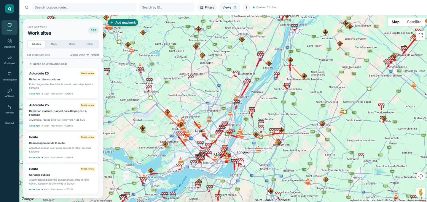
The map brings Québec 511 work sites and road closures into one review workspace. Open the image to explore the full map.
Road closures and lane restrictions can disrupt travel across Québec, but a closure listed in an official traffic feed does not necessarily appear correctly in a driver's navigation app. Without timely map updates, drivers may be routed toward blocked roads, encounter unexpected detours, or miss important information about conditions ahead.
The system turns Québec 511 road and lane closure reports into editor-verified restrictions published in Waze. By keeping navigation data closer to real road conditions, it helps drivers avoid closures, choose more efficient routes, and stay aware of disruptions around them. Waze data can also inform Google Maps, extending the potential value beyond Waze users. With navigation apps serving hundreds of thousands of drivers across the province, this workflow is designed for province-wide impact, although the number of drivers directly reached has not been measured.
The tool polls Québec 511 approximately once per minute for road and lane closure information.
A map-based editor supports manual confirmation, polygon editing, and snapping closures to road segments.
After editor confirmation, restrictions are published to Waze so routing can account for closures. Google Maps may also benefit through its use of Waze-sourced information; this tool does not publish directly to Google Maps.
Segment-name matching and overwrite checks help catch mismatches before confirmed closures are sent to Waze Map Editor.
Publication errors are returned to editors instead of being silently ignored. The tool is used by volunteer editors, including for recurring nighttime lane closures.
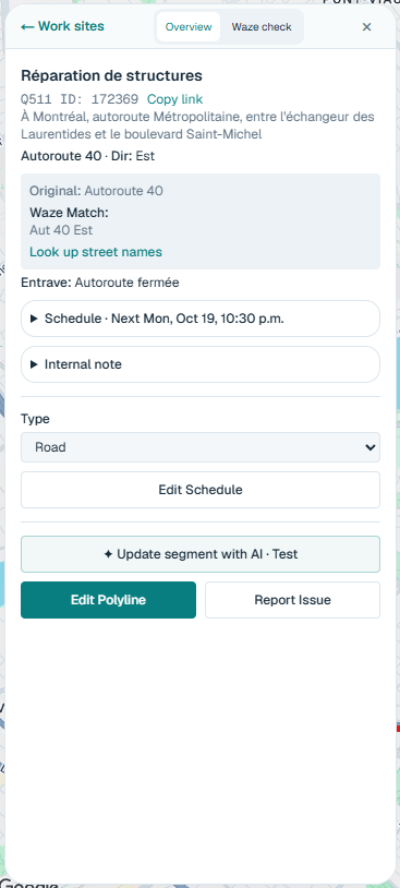
The closure editor pairs the source report with Waze matching, schedule controls, and polyline editing to support review before publication.
Volunteer-built, not an official MTMD, Waze, or Google Maps product. Driver reach and routing impact have not been independently measured.